|
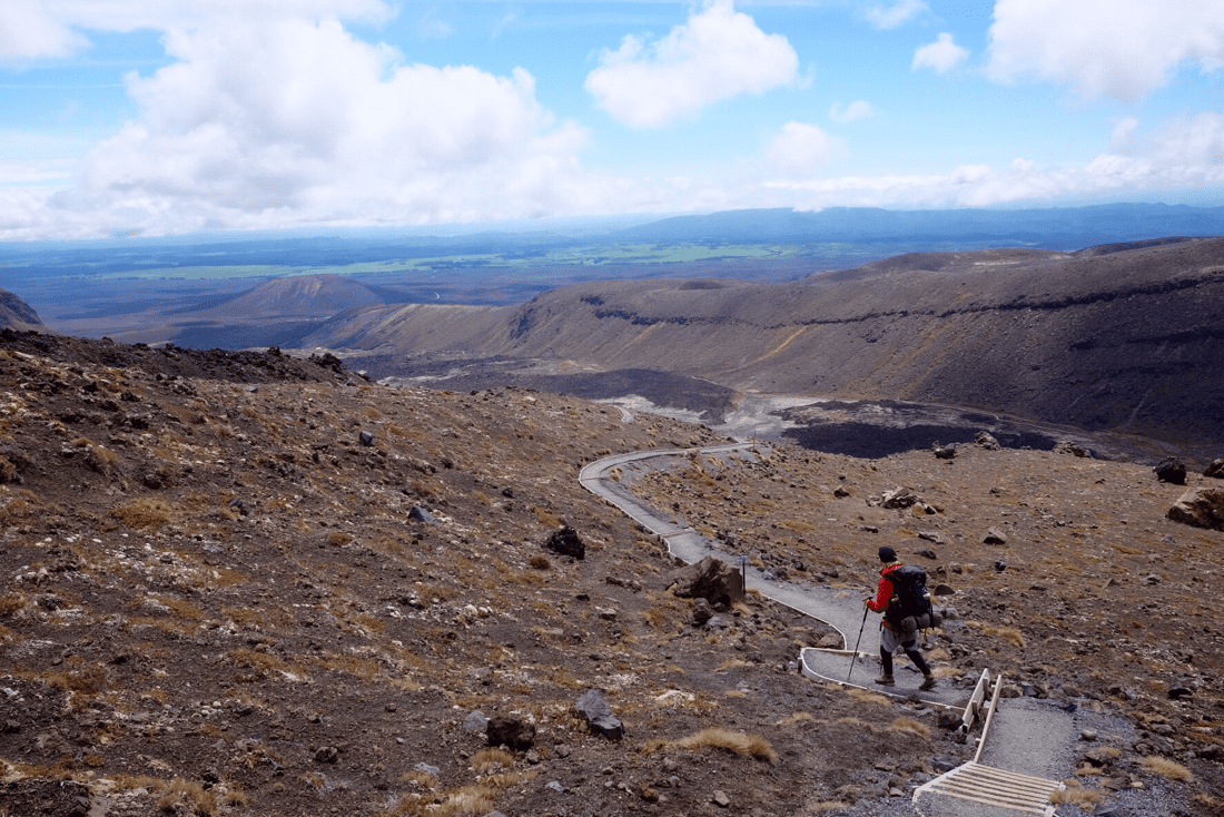
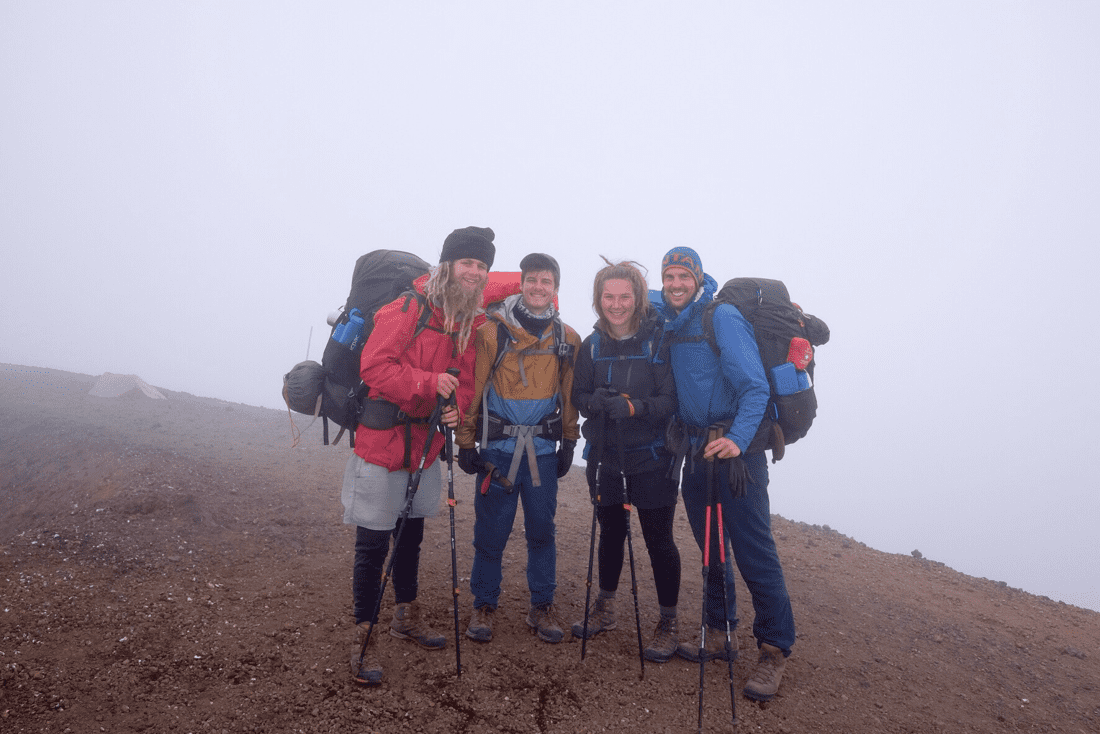
Distance = 28km Total = 1,145km Smell Factor = 8/10 We woke at 5:30 and it was freezing cold so we quickly ate breakfast with the morning sun beginning to light up the intimidating summits behind our camp spot. We were packed up and ready for the big day ahead, hitting the road at 7:05. The car park was busy with people being loaded onto busses so they could be taken round to the start of the crossing. We would be crossing backwards, because the TA never takes the easy option, and no one followed us but we did receive plenty of strange looks. The start was nice and gentle and due to its popularity the track was very well maintained. The climb got considerably steeper as we broke out above the tree line. As we emerged out of the woodland the views were amazing. The mountains loomed above us even though we were already quite high. Plumes of sulphur were being spewed out in brilliant white towers of smoke. The eggy sulphur smell filled the air but it only added to the wonder of the alien landscape, it also helped to cover our own hikers smell. The climb intensified after this, it was still a very good track which helped but the weight of our packs counter balanced this. The views continued to amaze and the eggy smell came and went dependent upon the breeze. We reached the first hut of the day nearly an hour ahead of the estimated time on the sign and so we rewarded ourselves with a hot chocolate. The hut had not been used since the last major eruption when it sustained considerable damage. The decking was still in one piece though and we enjoyed our hot chocolate and took in the spectacular view back down the valley and across the lake. 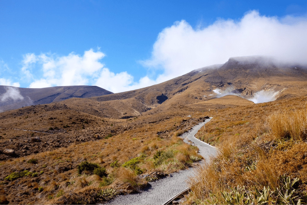 At this point we started to meet those who had started the crossing at the other end. They passed us in their hundreds, each saying hello. This became really rather tiresome after a while, especially when going up hill and with the weight of our packs. It was pleasant to see people though, some very under prepared for such a crossing, and we were frequently asked why we were going the wrong way and with such large, heavy backpacks. We continued to climb so much so that a tiny part of the track still had some snow on it. We were now in the clouds, the temperature plummeted and the wind picked up. The view back down the mountain disappeared adding even more to the mystical, other worldly feel. We reached the first crater and the blue lake. The rolling cloud cleared just enough for us to see this amazing volcanic lake. We wandered on to the emerald lakes and rested here for a while whilst we had our lunch. The visibility came and went but people just kept appearing through the cloud. 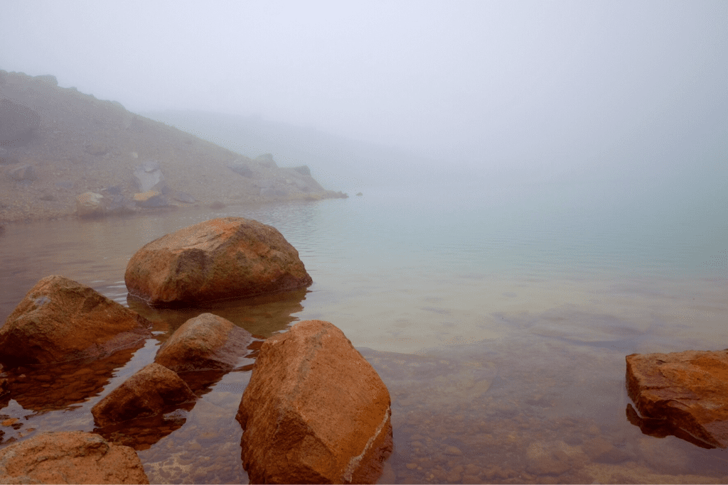 The steepest climb of the day followed, the weight of our bags really didn't help with the poor traction of the lose scree under foot. This climb took us to the heights point of the trail so far (over 1,800 meters above sea level). After catching our breath and playing some 'Rocky' as we reached the summit a short descent took us into the main volcanic crater. The landscape was like something out of a sci-fi movie, apart from gravity weighing us down we could have easily been on another planet. We decided against attempting to summit Mt Ngauruhoe (Mt Doom) due to the weather and the weight of our bags. Tom and I declaring that we would conquer the summit on our way back through New Zealand when we would be able to do it without our entire lives on our backs, the precious summit will be ours!!! The view cleared as we descended and it was as spectacular, if not more so, than the climb had been. We headed off the main crossing, this track was nowhere as well maintained. This coupled with fatigue setting in meant our pace dropped. We stopped to cook and eat dinner on a bridge, like some sort of middle earth trolls, so we would have enough energy to reach our end goal and the potential comfort of Whakapapa village. After 13 and half hours of hiking we reached the village around 8:30. Not knowing where to camp we headed for a ski hotel. This hotel just happened to have a bar, fancy that, and so we celebrated our long day and hard effort with a beer each, a Coke each, and a massive bowl of chips each. We eventually dragged ourselves out the comfortable chairs and found the campsite around 10 ish. We managed to set our tents up in a small free patch and all made the most of the hot showers, separately! Feeling clean, exhausted, and proud of our efforts I crawled into my little castle and slipped into bed. What an amazing day. 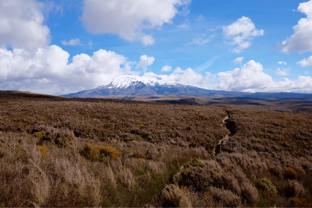 The Turner.
0 Comments
Distance: 24km, 23km, 19km. Total: 1117km. Smell Factor: 5/10.
As we left the camp we begun vearing south- east towards the North Island's volanic heart; the Tongario National park. The Tongario croasing is hailed as one of New Zealand's 10 great walks and represents one of the more dramatic terrain tranisions we will encounter on the trail. As such, the next few days would be a gradual ascent to the base of the crossing via the forested 42 traverse. The traverse was steep in parts and very undulating; diving into valleys and through various rivers. It was a wide semi-maintained track good enough for quad bikes. Such conditions allow good progress and we were only slowed by deeper river crossings. Towards the later part of the day the forest path opened up in front and we were greeted with the not so distant peaks of Mt Ngauruhoe (Mount doom) and Mt Ruapehu. The following day the snowy peaks became ever closer and our excitment grew. We camped at the base in a grassy layby in prime position for our crossing. After a minor mishap Luke & I jogged back down the road to retrieve drinkable water. We had not realised the mineral content in the stream was unsafe. We got lucky and managed to fill our reserves only 3km down the road with a very cheery local and hitched back with some lost swiss fellas. Problem solved, we hit the hey (seperately). The Hobbit. |